Tips
Find a Photo's Location
December 23, 2024

Finding Photo Locations: From Metadata to Modern Methods
Ever since people started posting pictures online, one question keeps popping up: "Where was this photo taken?" The reasons behind this question are pretty diverse, ranging from simple curiosity to public safety and national security. While we could spend ages diving into all the different use cases and niche industries where this matters, let's focus on what's really interesting - the how.
When we first started letting people post images online, platforms were way more focused on getting people to share photos than protecting privacy. Take Flickr, for example - they actually let you look at a map and see exactly where users' photos were coming from. This was all possible thanks to something called metadata.
For those who don't know, metadata is basically data about data. In photos, it includes all sorts of information about how and where the picture was taken. As we started putting cameras and GPS in phones, we began fusing all this data together. When you take a photo now, your device can include things like focal length, camera model, and GPS coordinates. It's super useful - just check your iPhone or Google Photos and you'll see GPS tags reminding you of all the places you've been.
But here's where things get tricky - when we start posting photos of our lives in public. That cute bathroom selfie might accidentally reveal where that bathroom is. Platform providers caught on pretty quick, and nowadays, when you upload a photo online, most platforms strip out all that metadata.

As more things have moved online, interest in photo geolocation has grown even more. So you might ask, "How do we find where someone is if there's no metadata?" Truth is, it's complicated - and it's something we at Graylark have been thinking about for a while. Let's cover some basics.
Photo geolocation falls under GEOINT (geospatial intelligence). There are entire teams in government agencies worldwide whose job is to look at pictures and figure out where they were taken. What's really interesting is that these folks often use the same tools and tricks we're going to discuss here.
Three Ways to Find Photo Locations:

1. Manual Methods
This is the old-school approach - manually examining every detail, searching databases of signs, translating languages, and so on. It's often slow and tedious but has been the backbone of photo geolocation for a long time.
2. Computer Vision Tools
These range from Google Lens to GeoSpy. They can provide additional clues about a location - like doing a reverse image search on a tree and finding out it's native to West Africa.

3. Hybrid Approach
This combines both tools and manual searching. Even though computers have gotten incredibly good at certain tasks, photos shared online have so many variables and conditions that human intuition is often still needed to pick up on the right details.
Let me share a real example: A local police officer was alerted about someone posting a photo on Instagram with a threatening caption and a pistol on a countertop. Concerned about community safety, they needed to act fast. The officers took real estate listings from their city and went through all the kitchen photos. Eventually, they found a listing with matching counter patterns, verified the person's location, and intervened before any threat materialized.
The Tools We Use
Let's break down our tools into three categories: search, retrieval, and classification.
Search Tools:
- Regular search engines (Google, Bing) have tons of information you can dig through about signs, restaurants, parks, etc.
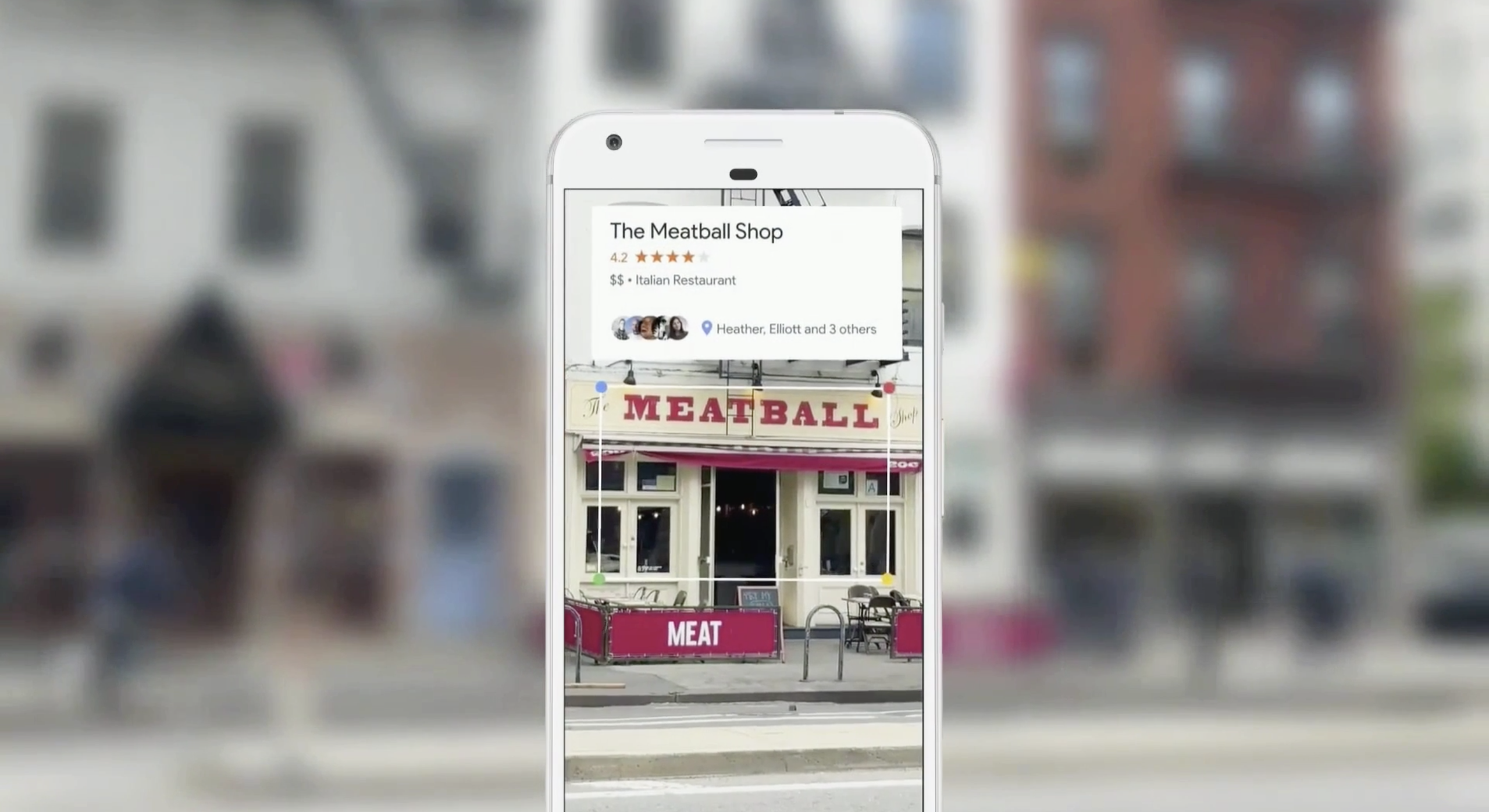
- Social media platforms like Instagram and Facebook act as human-labeled image databases, with helpful captions and location tags.
Retrieval Tools:
The real magic happens with tools like Google reverse image search, TinEye, and Yandex. These systems use vector search, which is fascinating stuff. Instead of trying to describe an image with words (which could match thousands of other images), these tools use the image itself for searching.
These platforms have built massive databases of billions of images. They use embedding models to take an image and distill it down into a short list of numbers that encode meaning. When you search for a popular place, these tools usually give you the correct answer immediately - if enough people have taken photos there.
Limitations:
Why can't we do this for every possible image? There are a couple of key limitations:
- Limited photo coverage in certain areas (like North Korea)
- Technical limitations of vector embedding models
- Challenges with specific conditions (like nighttime photos)
Advanced Techniques:
When these tools hit their limitations, we move into more sophisticated methods. One classic approach is analyzing shadows - since the Earth's rotation and seasonal changes affect shadow lengths and angles. People can manually measure these shadows relative to known objects like the height of a person or length of a car.
For really advanced searching, there are tools like Overpass Turbo. It lets you search for locations matching specific criteria. For example, if you have a photo of a church next to a cafe with only the first four letters visible, and you spot a German flag, you can search for locations in Germany with cafes (matching those letters) within a certain distance from churches.
Going Beyond Basic Tools
Let's dive into some advanced techniques that really separate the pros from the amateurs in photo geolocation.
Weather Analysis
This is a seriously underrated tool in our arsenal. Think about it - weather patterns are like nature's timestamps. You see clouds in the photo? Those patterns can help narrow down both location and time. If there's snow on the ground or trees changing colors, boom - you've got your season. What's really cool is that you can cross-reference specific weather events with historical data. Had a distinctive storm that day? That's a golden ticket for verification.
Technical Deep Dives
While we talked about metadata earlier, there's way more to the technical side:
- EXIF data can tell you way more than just location - camera settings can hint at lighting conditions
- Digital terrain mapping helps match landscapes
- Satellite imagery lets you track changes over time
- Power line configurations are like fingerprints - they're surprisingly unique
- Construction materials can tell you a lot about the region
Getting Clever with Searches
It's not just about throwing an image into Google. Pro tips:
- Use custom Google search operators to zero in on specific regions
- Dig through local business databases
- Check historical image archives
- Look up building permits (especially useful for construction sites)
- Real estate listings are gold mines for interior shots
Verification is Key
Never trust a single source. Here's how we verify:
- Shadow analysis for time verification
- Cross-reference with other photos from the same set
- Check local news archives
- Sometimes, you just need to talk to locals
Modern Tech
The tech is getting crazy good:
- ML models that can identify architectural styles
- Automated systems that can analyze vegetation types
- Software that can build 3D models from 2D photos
- GIS databases that map everything from power lines to tree types
- Crowd-sourcing platforms where locals can help verify locations
Common Roadblocks
Let's be real - this isn't always easy. You'll run into:
- Super old photos where everything's changed
- Photoshopped or edited images
- Pictures so blurry you can barely see anything
- Areas that developed so fast Google Maps hasn't caught up
- Places that look identical (looking at you, chain stores)
The Future is Wild
We're seeing some really exciting new tech:
- AR/VR tools that let you virtually walk around locations
- Blockchain systems for verifying image authenticity
- Real-time satellite imagery (game-changer for verification)
- AI systems that are getting scary good at recognition
- Tools that can figure out when a photo was taken just from the image
Investigation Strategies
When you're working on a tough geolocation problem, here's a solid approach based on real investigations:
1. Start with the Basics
- Always check metadata first - even if there's no GPS data, you might get date, time, or camera info
- Look for distinctive features - walls, signs, architectural styles
- Consider the context - is it a conflict zone? Tourist area? Residential?
2. Expand Your Search Radius
- Look for other photos from the same source/photographer
- Search news reports from the same date
- Check conflict monitoring tools for relevant areas
- Use multiple search engines (don't just stick to Google)
3. Get Creative with Languages
- Search in local languages - you'll often find way more relevant results
- Use local social media platforms
- Look for local news sources
- Consider regional naming conventions
4. Cross-Reference Everything
- Compare satellite imagery from different dates
- Match architectural features across multiple sources
- Verify with local social media posts
- Use mapping tools to confirm distances and relationships between landmarks
5. Document Your Process
- Keep track of your search terms
- Save important images and links
- Note down dead ends (they might be useful later)
- Record your reasoning for each conclusion
The Big Questions
As we push forward with these technologies, we're dealing with some heavy questions:
- Social media has completely changed the game - is privacy even possible anymore?
- Where's the line between security and surveillance?
- Different countries handle this stuff completely differently - should there be a global standard?
- As AI gets better, will we still need human analysts?
- How do we balance the need for quick results with accuracy?
Let me share a real-world example that perfectly illustrates how these techniques come together. Recently, there was a challenge to geolocate a photo showing a distinctive mural on a building wall next to what appeared to be a local market. The catch? It was in a remote town where Street View wasn't available. Here's how it was solved:
1. First step was checking the metadata (EXIF data) using tools like Jimpl. While there wasn't GPS data, it revealed crucial details like the photographer's name, date, time, and general location (a region in Southeast Asia).
2. This led to searching local news sites for coverage of mural artists in the area - smart way to get more context.
3. Using local tourism websites and forums, they found mentions of a cultural district known for its street art.
4. The investigator got creative with social media:
- Searched in the local language to access community sources
- Found Instagram posts showing similar artistic styles
- Discovered TikTok videos of the market area
- Located YouTube travel vlogs of the region
5. By piecing together these clues, they identified the mural as part of a local arts festival, and confirmed the location by finding pictures of the same market from different angles.
What makes this case fascinating is how it worked around the limitations: no Street View, limited satellite imagery, and a relatively undocumented area. It shows that photo geolocation isn't just about having the right tools - it's about thinking outside the box and putting in the effort. While tools help, they're not (yet) a replacement for human judgment. You need to be part detective, part tech wizard, and part creative thinker. Though as the GeoSpy team, we're working on making those tools smarter every day! 😉


